Lone Wolf

Lone Wolf

Created by Joe Dever in 1984, Lone Wolf is one of the most influential and enduring gamebook series ever published. Set in the world of Magnamund, the saga has introduced generations of readers to interactive fantasy storytelling, blending narrative, exploration, strategic decision-making, and richly developed worldbuilding. Over the decades, the series has become a landmark of the gamebook medium, earning an international audience and leaving a lasting influence on both interactive fiction and tabletop gaming.

Client
Jambô Editora
Date
March 2022
Dimensions
29,7 × 21 cm
Type
Regional maps

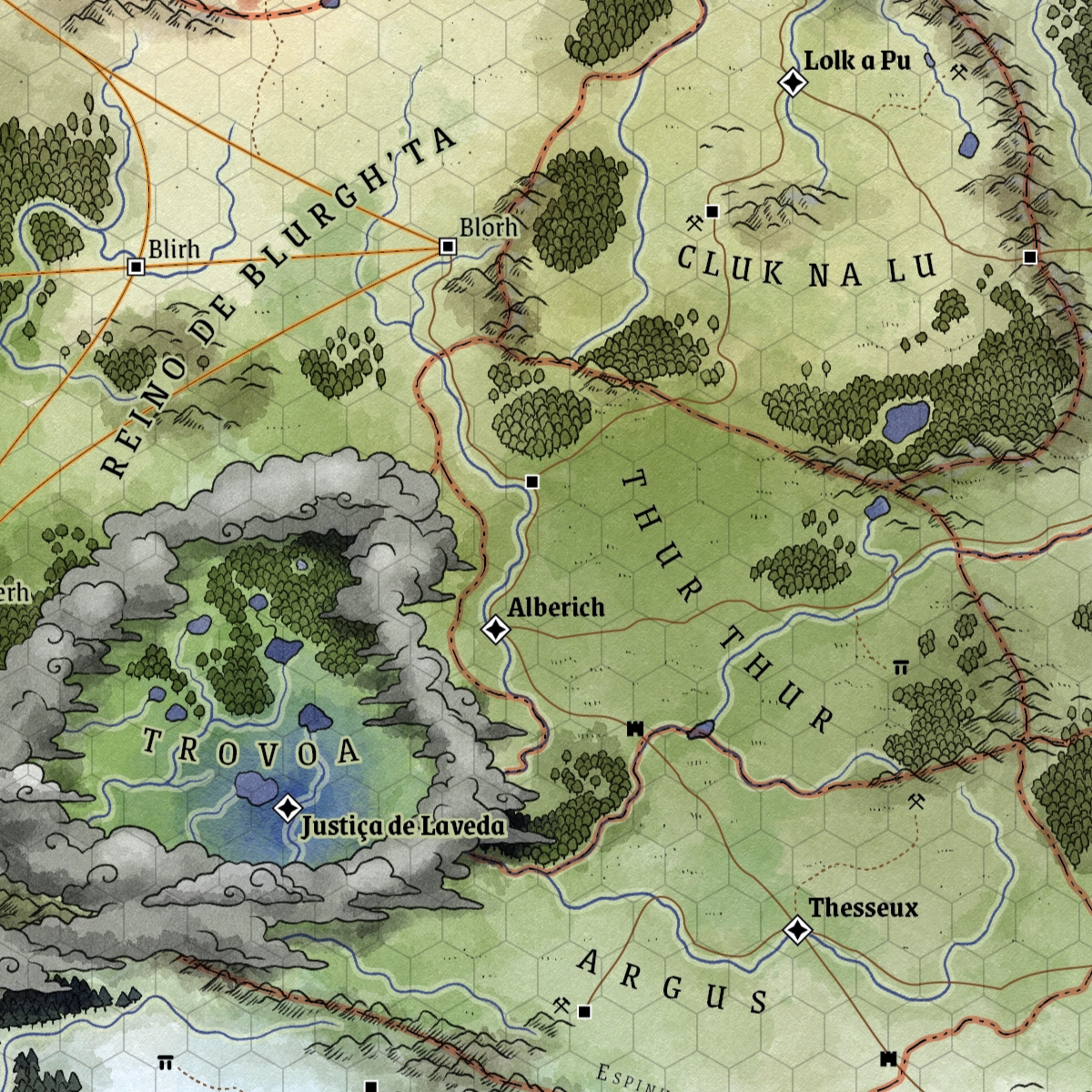
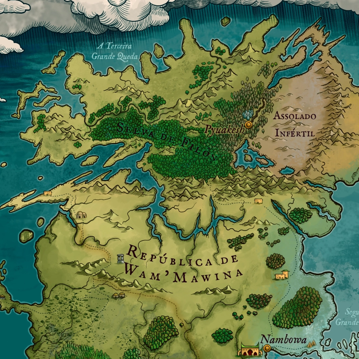
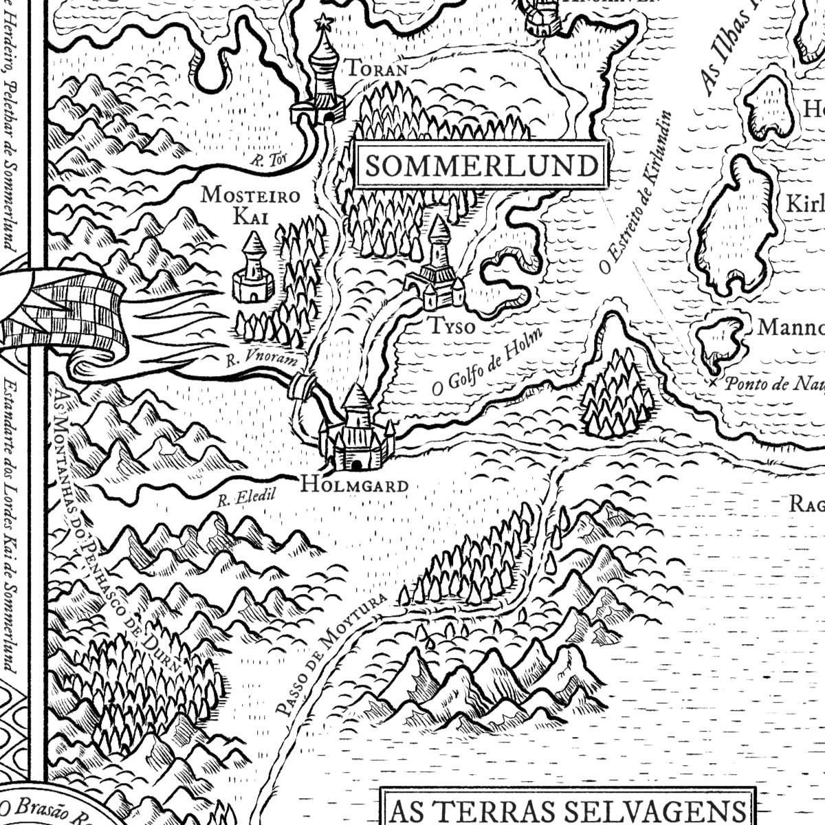
Developed in 2022 for the Brazilian edition of Flight from the Dark, the first volume of the series, this map depicts the Northern Free Kingdoms of Magnamund, the setting of Lone Wolf’s initial journey. The piece was designed to provide readers with a clear geographical understanding of the world while reinforcing the epic scope of the adventure.

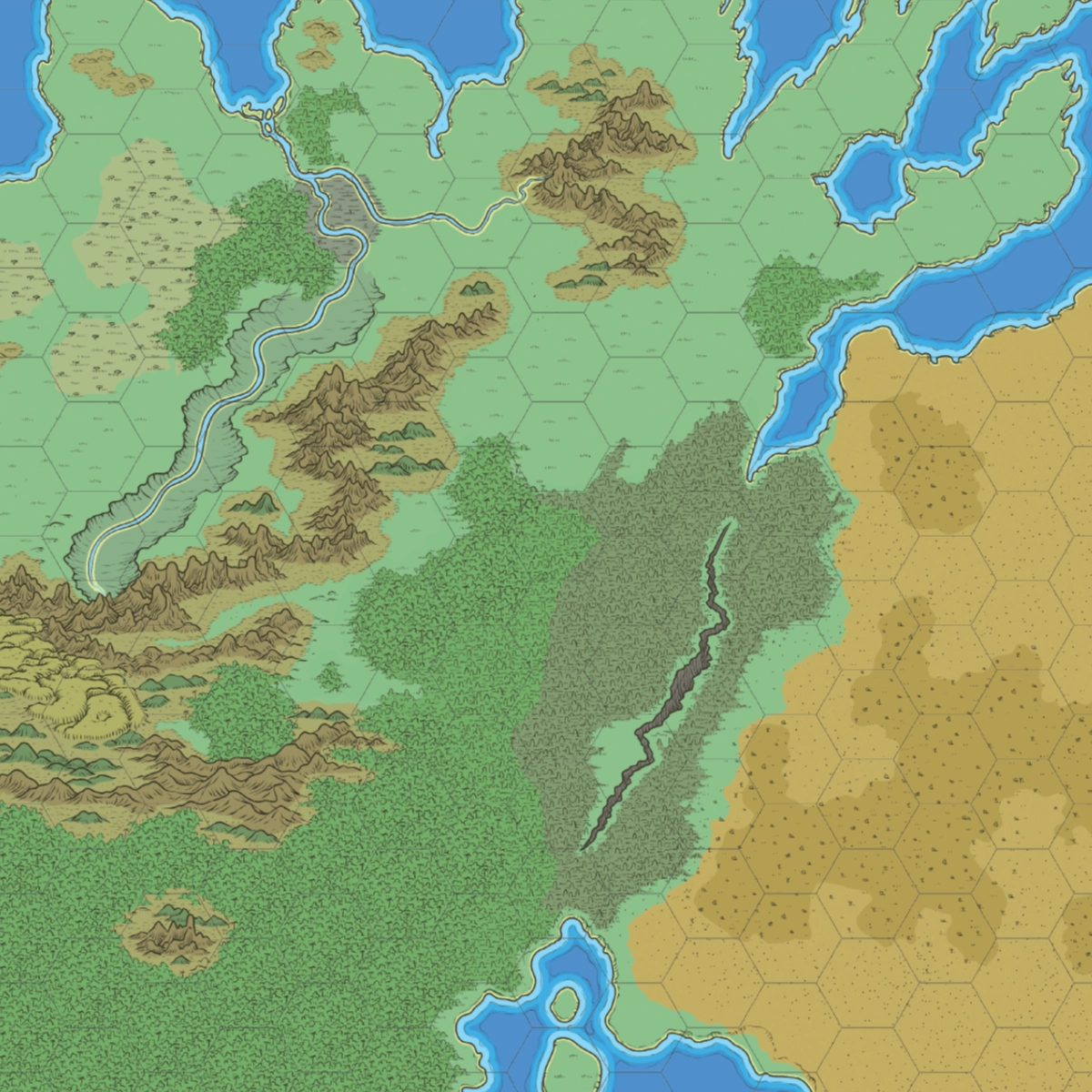
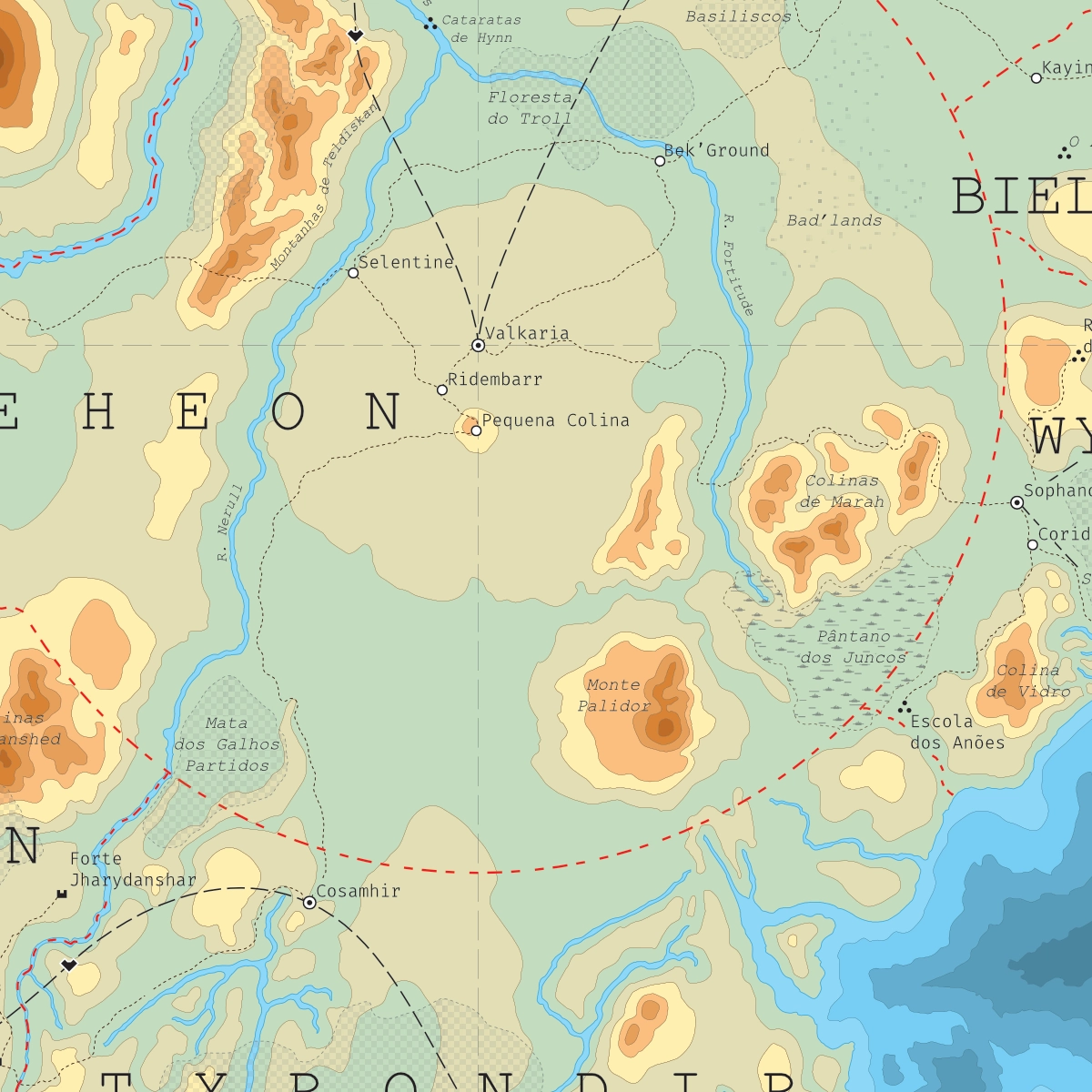
A second map was produced in 2024 for The Chasm of Doom, the fourth volume in the series. It focuses on southern Sommerlund and its frontier with Vassagonia, one of Magnamund’s most strategically and politically significant regions. Particular attention was given to presenting the complex relationship between the two realms and to supporting the exploration-driven structure that defines the Lone Wolf experience.

Codename Hourglass

Codename Hourglass

Skyfall RPG is one of Brazil’s leading contemporary fantasy roleplaying games, published by CapyCat Games. Set in the world of Opath, the game is known for its expansive worldbuilding, rich mythology, and a setting shaped by cataclysmic events known as the Falls, which dramatically altered the geography, cultures, and history of the world.

Client
Pedro Coimbra
Date
January 2022
Dimensions
42 × 29,7 cm
Type
Regional map

Created for the Codename Hourglass campaign, this map depicts an alternate version of Opath in which only one of the Falls ever took place, presenting a radically different vision of the setting and its history. Conceived as an in-world artifact supposedly illustrated by a triton mage, the piece explores cartography from the perspective of one of Opath’s own inhabitants rather than as an objective representation of geography.

To reinforce this narrative premise, the artwork was designed to emulate the materials and artistic sensibilities that such a character might employ. Watercolor textures, ethereal outlines, and fluid forms were used throughout the map, resulting in a dreamlike aesthetic that blurs the boundary between geographic document and magical illustration.

The Third Great Fall

The Third Great Fall

Skyfall RPG is one of Brazil’s leading contemporary fantasy roleplaying games, published by CapyCat Games. Set in the world of Opath, the game combines epic fantasy, extensive worldbuilding, and a rich mythological background shaped by cataclysmic events known as the Falls, which have repeatedly transformed the geography and history of the setting.

Client
Pedro Coimbra
Date
January 2021
Dimensions
84,1 × 59,4 cm
Type
Regional map

This map depicts the region devastated by the Third Great Fall, one of the most significant events in Skyfall’s chronology. Conceived as a hexcrawl tool for exploration-driven campaigns, the piece was designed to support open-ended play focused on discovery, travel, and wilderness adventure in a landscape forever altered by catastrophe.

The art direction draws direct inspiration from the classic 1980 World of Greyhawk map illustrated by the legendary cartographer Darlene. The project seeks to pay homage to this foundational tradition of tabletop RPG cartography, combining a game-oriented structure with an aesthetic reminiscent of the great fantasy settings of the hobby’s early decades. Particular attention was given to clarity, navigability, and the sense of wonder essential to exploration-focused play.

To support the needs of a live-streamed campaign, numerous location icons were created as separate assets and added to the map over time, allowing new places and points of interest to emerge organically as they were discovered during play.

The Lands of Opath After the Third Fall

The Lands of Opath After the Third Fall

Skyfall RPG is a Brazilian epic fantasy roleplaying game set in the world of Opath, a setting defined by cycles of cataclysmic events known as the Falls. These world-altering disasters reshape continents, transform civilizations, and leave lasting marks on the history, geography, and cultures of the setting, making change itself one of Skyfall’s central themes.

Client
Pedro Coimbra
Date
December 2020
Dimensions
42 × 29,7 cm
Type
Regional map

This map depicts the continent of Opath in the aftermath of the Third Great Fall, one of the most pivotal events in the chronology of Skyfall RPG. Developed to highlight the profound consequences of the cataclysm, the piece presents new political borders, settlements, and geographical features that emerged in the wake of the disaster.

Conceived as both a reference tool and a worldbuilding resource, the map allows players and readers to compare different stages in the evolution of the setting, illustrating how history, catastrophe, and human resilience have continually reshaped the face of Opath. Particular attention was given to communicating the scale of these transformations while preserving the continuity and identity of the world across different eras.

The Forgotten West

The Forgotten West

This personal project was created for a West Marches-style tabletop RPG campaign, a format centered on player-driven exploration and the gradual discovery of an unknown world. Rather than presenting a fully documented setting from the outset, the map was designed to reveal its secrets over time: players begin with only fragmentary and often illegible information, which slowly gains meaning as their journeys unfold and their knowledge of the region expands.

The illustration was heavily inspired by the iconic third edition Forgotten Realms map of Faerûn, seeking to evoke the sense of wonder and open-ended exploration associated with classic fantasy campaign settings. The typography follows the same inspiration, employing the Dethek alphabet—the script traditionally used by dwarves within the Forgotten Realms setting.

Client
Personal project
Date
February 2020
Dimensions
59,4 × 42 cm
Type
Regional map

As a personal exploration of cartographic storytelling, the project focuses on how a map can function not merely as a geographic reference, but as a game mechanic in itself, transforming the act of reading and deciphering the map into part of the adventure.

Elevation Map of the Central Reinado

Elevation Map of the Central Reinado

Tormenta is Brazil’s longest-running fantasy roleplaying setting and one of the country’s most influential fantasy properties. Long before contributing professionally to the line through projects such as the Atlas of Arton, I was already creating fan cartography inspired by the setting and exploring its geography through personal projects.

This map presents an estimated elevation model of the central region known as the Reinado in Arton, focusing on Deheon and the surrounding kingdoms. Developed as a fan work, the project was based primarily on the official maps published in O Reinado d20 (2004) and O Mundo de Arton (2013), seeking to extrapolate the terrain and topography implied by the original cartography.

Client
Personal project
Date
July 2019
Dimensions
21 × 29,7 cm
Type
Regional map

Created in 2019, the map reflects the state of the setting prior to the release of Tormenta20 and before my later professional work on the Atlas of Arton. As such, it offers a fascinating snapshot of both the evolution of the setting and my own development as a cartographer, bridging the gap between fan-created material and the official projects that would follow in subsequent years.