Elevation Map of the Central Reinado
Tormenta is Brazil’s longest-running fantasy roleplaying setting and one of the country’s most influential fantasy properties. Long before contributing professionally to the line through projects such as the Atlas of Arton, I was already creating fan cartography inspired by the setting and exploring its geography through personal projects.
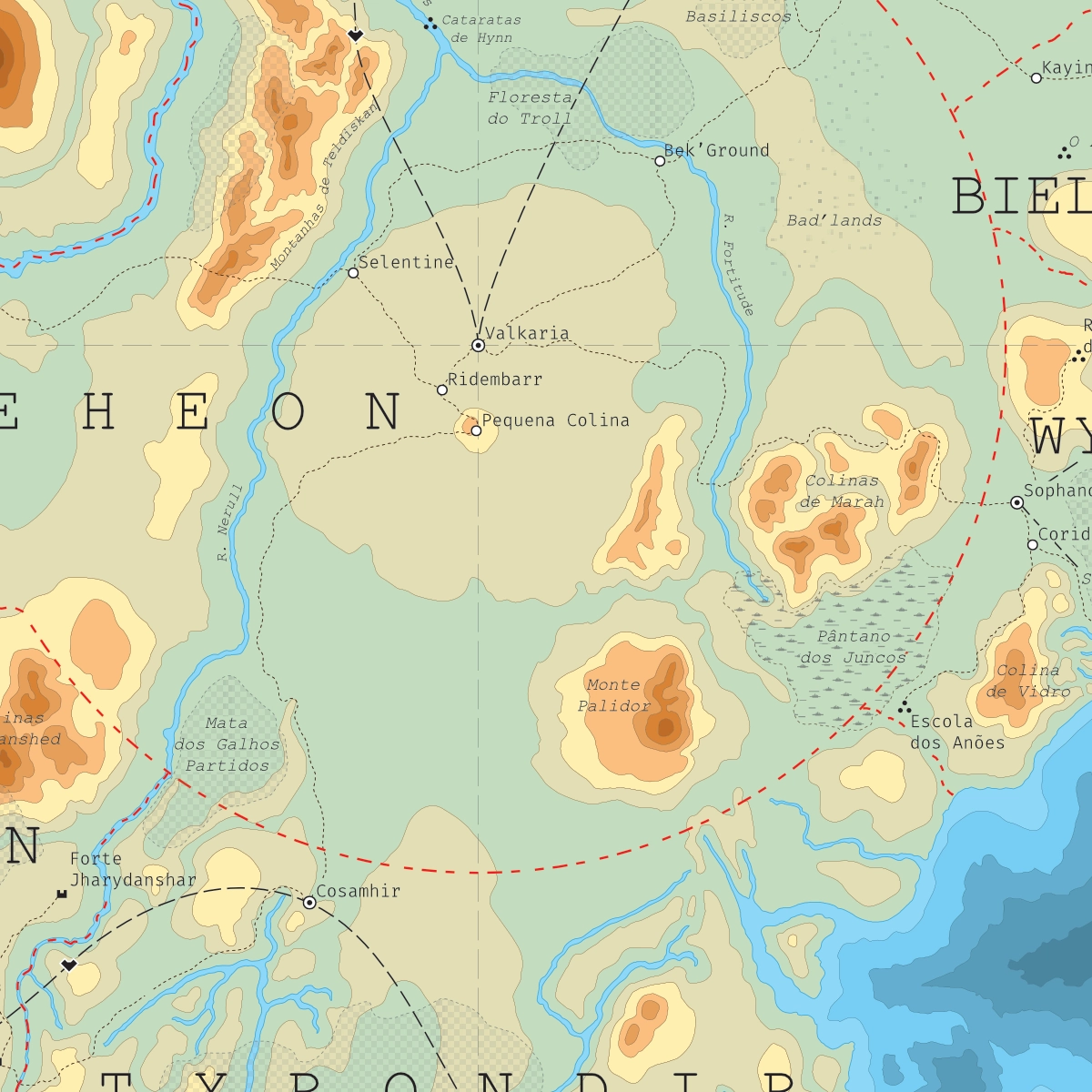
This map presents an estimated elevation model of the central region known as the Reinado in Arton, focusing on Deheon and the surrounding kingdoms. Developed as a fan work, the project was based primarily on the official maps published in O Reinado d20 (2004) and O Mundo de Arton (2013), seeking to extrapolate the terrain and topography implied by the original cartography.
Created in 2019, the map reflects the state of the setting prior to the release of Tormenta20 and before my later professional work on the Atlas of Arton. As such, it offers a fascinating snapshot of both the evolution of the setting and my own development as a cartographer, bridging the gap between fan-created material and the official projects that would follow in subsequent years.